|
#2
4th March 2016, 09:11 AM
| |||
| |||
| Re: Where is Maldives Islands on a Map
The Maldives, a Group of About 1,200 Islands, Separated into a Series of Coral Atolls, is just North of the Equator in the Indian Ocean. Only 200 of the islands are inhabited. It has a population of 393,988 and celebrates their National Day on July 26th. The Country of Maldives is in the Asia Continent and the Latitude and Longitude for the Country are 4.1667° N, 73.5000° E. The neighboring countries of Maldives are: Maritime Boundaries India Sri Lanka British Indian Ocean Territory Location of Maldives on World Map 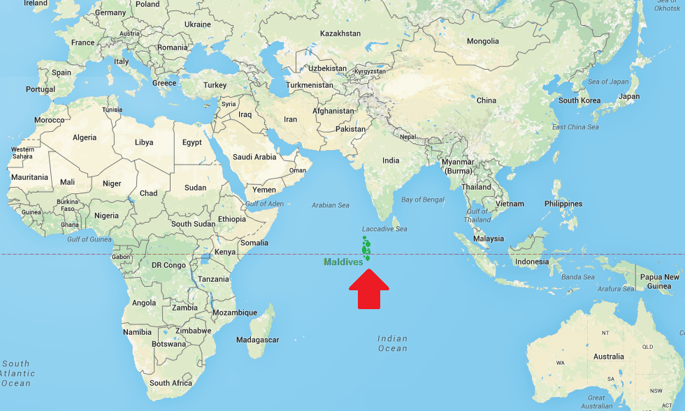 Facts About Maldives Country Name Maldives Continent Asia Capital and largest city Male Area 298 km2 (115 sq mi )Water (%) 99 Population 393,500 (2013 Est. ) Lat Long 3° 12′ 0″ N, 73° 13′ 12″ E (3.2, 73.22) Official Language Maldivian (Dhivehi) Calling Code +960 Time Zone MVT (UTC+5) Airport Ibrahim Nasir International Airport Neighbour countries India, Sri Lanka, British Indian Ocean Territory Internet TLD .mv Currency Maldivian rufiyaa (MVR) |